


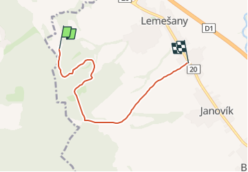

5.5 km | 8.3 km-effort


Tous les sentiers balisés d’Europe GUIDE+


FREE GPS app for hiking
 SityTrail
IGN / Geographical institutes
SityTrail World
The world is yours!
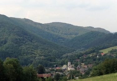
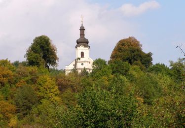
Trail On foot of 4.9 km to be discovered at Region of Prešov, Unknown, District of Prešov. This trail is proposed by SityTrail - itinéraires balisés pédestres.
Trail created by Záhrada pohybu.
symbol for all 4 routes is actually green backslash but routes have separate colors on guideposts


On foot

On foot
On foot